
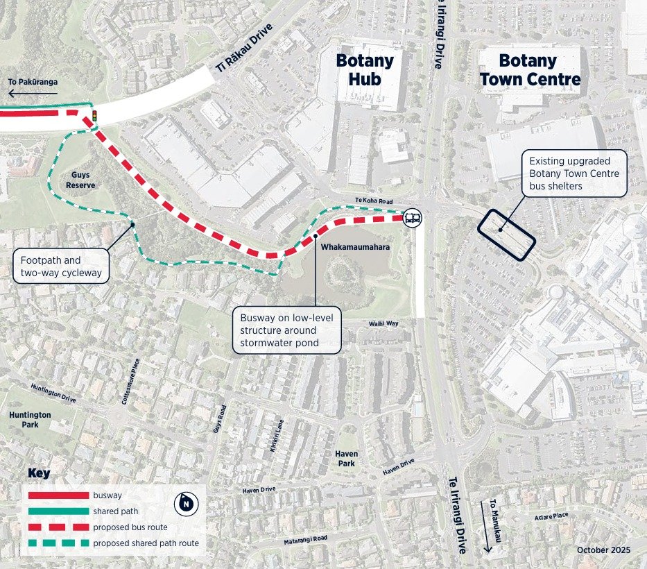
Eastern Busway final leg to Botany now funded!
Great news - Auckland Transport and NZTA have confirmed that the Eastern Busway will be completed through to Botany!
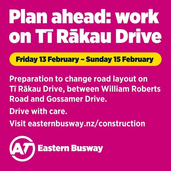
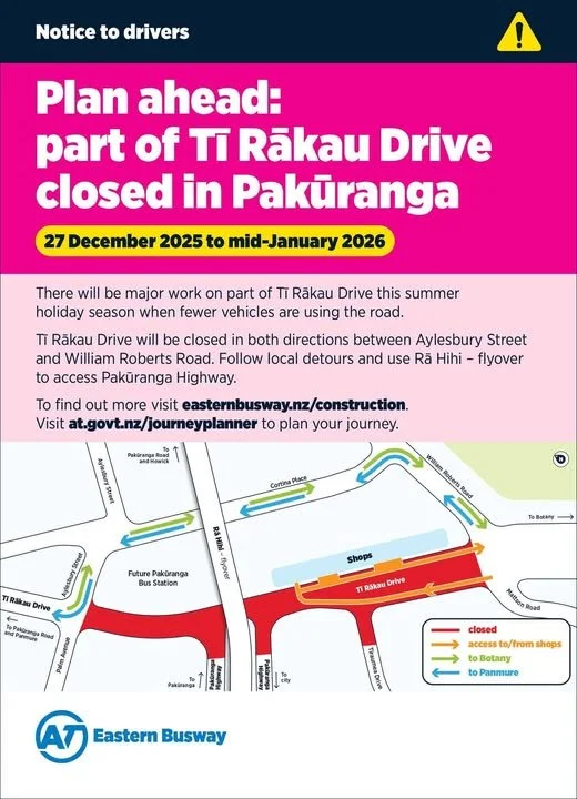
Ti Rākau Drive road changes from 13 February
Between William Roberts Road and Gossamer Drive, new stormwater pipes will be installed to help prevent flooding. Between William Roberts Road and Gossamer Drive, new stormwater pipes will be installed to help prevent flooding.
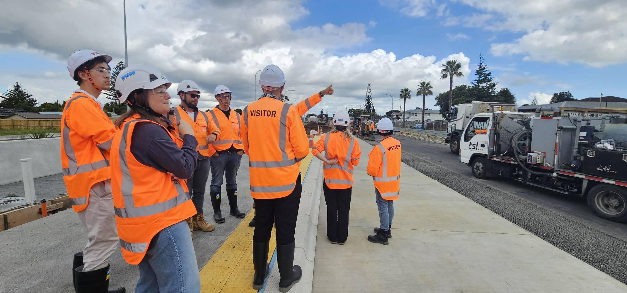
Tour of Eastern Busway
Before our Howick Local Board workshop last week, we were given the opportunity to do a site tour of the Eastern Busway Project.
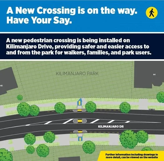
Have your say on proposed Kilimanjaro Drive crossing
The Howick Local Board has asked Auckland Transport (AT) to investigate pedestrian safety near Kilimanjaro Park in Northpark, Botany.

Proposed changes for Golfland Dr / Botany Rd / Tarnica Rd intersection
Golfland Drive and Botany Road intersection


Business East Tāmaki transport breakfast
Thank you Business East Tāmaki for hosting another fantastic breakfast meeting this morning.

More safety improvements coming for The Parade, Bucklands Beach
The Howick Local Board (HLB) has been working with Auckland Transport (AT) on safety improvements for The Parade, Bucklands Beach.

Rā Hihi flyover officially opened
As the sun rose over Pakūranga, we walked over Rā Hihi in preparation for its opening.

Consultation on Kerrykeel Drive, Flat Bush
Ormiston Primary School, along with residents, parents and the wider Flat Bush community, has raised concerns about pedestrian safety and high traffic speeds in the vicinity of the school.

Consultation on Sunnyview Ave
In response to community concerns about the lack of crossing facilities on Sunnyview Avenue, the Howick Local Board asked Auckland Transport to investigate options to make it safer for children and families to get to Shelly Park Primary School.

Consultation on Stage 2, The Parade Bucklands Beach
The Parade on Bucklands Beach is a popular destination for families and local residents. After years of complaints and concerns from local residents about unsafe driving, the Howick Local Board asked Auckland Transport to improve safety through speed calming.

Eastern Busway connecting communities and driving growth
Eastern Busway will provide more transport choice for East Auckland. But it's also an opportunity for urban regeneration.

Mahi toi (artwork) unveiled at Half Moon Bay
Beautiful mahi tai (artwork) unveiled at dawn this morning at the Half Moon Bay Ferry Terminal.

Road safety dashboard provides transparency
In the past 5 years, 15 people were killed on roads within the Howick Local Board. 162 received serious injuries (requiring medical or hospital care) and 947 received minor injures.


Progress on Mill Road good news for locals
Recently the Howick Local Board received an update from NZ Transport Agency Waka Kotahi about the Mill Road Project. This has been selected by the Government as part of their Roads of National Significance (RONS).

Eastern Busway update June - changes for Pakūranga and Tī Rākau Drive
More changes for Pakūranga and Tī Rākau Drive:

Final Eastern Busway Update for 2024
The project team has out together this great video showcasing the amazing work they've been up to this year, with some great flyover shots of the progress to date.